
Vector Scope AI
Collaborative map updates, without the GIS bottleneck
Try the live map—no login. Select a feature, propose an edit, and see it on the change list.
One dataset free (under 25 MB). Open the files in QGIS, ArcGIS Pro, or DuckDB—they are not stuck in our app.
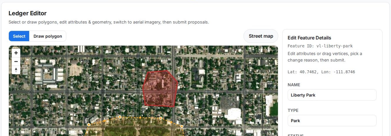
This is the real public sandbox. Edits you submit stay pending until they are reviewed.
Opens the real public sandbox full screen. Edits stay pending until they are reviewed.
A hosted place for the map to live while people are still arguing over the last edit.
Staff and partners propose changes. Approvers see what moved. When you publish, you get files desktop GIS and analytics tools can actually open—not a screenshot of a web map.
Ledger Setup: Create a sandbox, drop in a shapefile zip, convert to GeoParquet
Ledger Editor: Draw and edit features on the map—adds, edits, and deletes stay pending until someone approves
Ledger Dashboard: See the change list, invite editors / approvers / viewers
Ledger Lake: Publish GeoParquet, PMTiles, and a MapLibre preview
Open the files in QGIS, ArcGIS Pro, or DuckDB
Share a stable Ledger URL—not a one-hour S3 link you have to babysit
Try the live map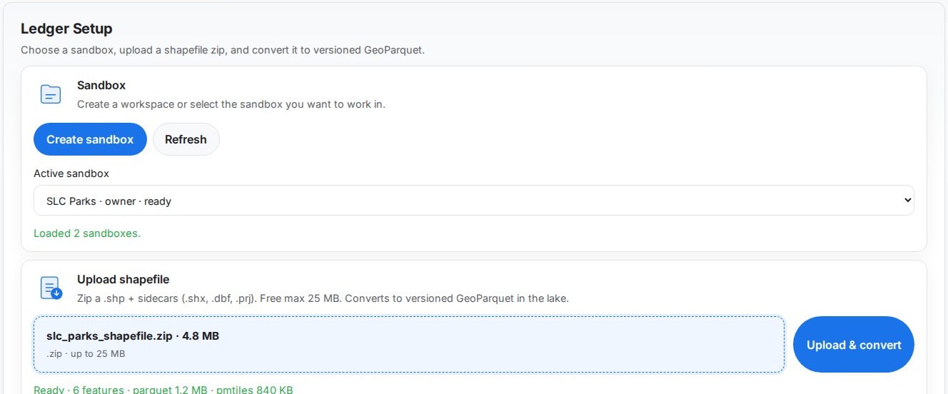
Create a sandbox, upload a shapefile zip, convert to GeoParquet
Draw and edit on the map. Changes stay pending until they are approved
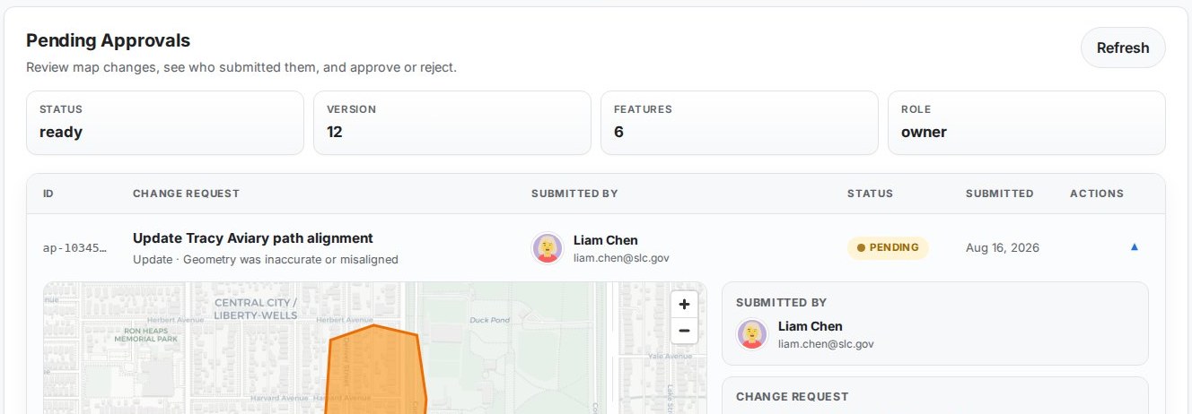
Review the change list, assign editor / approver / viewer roles
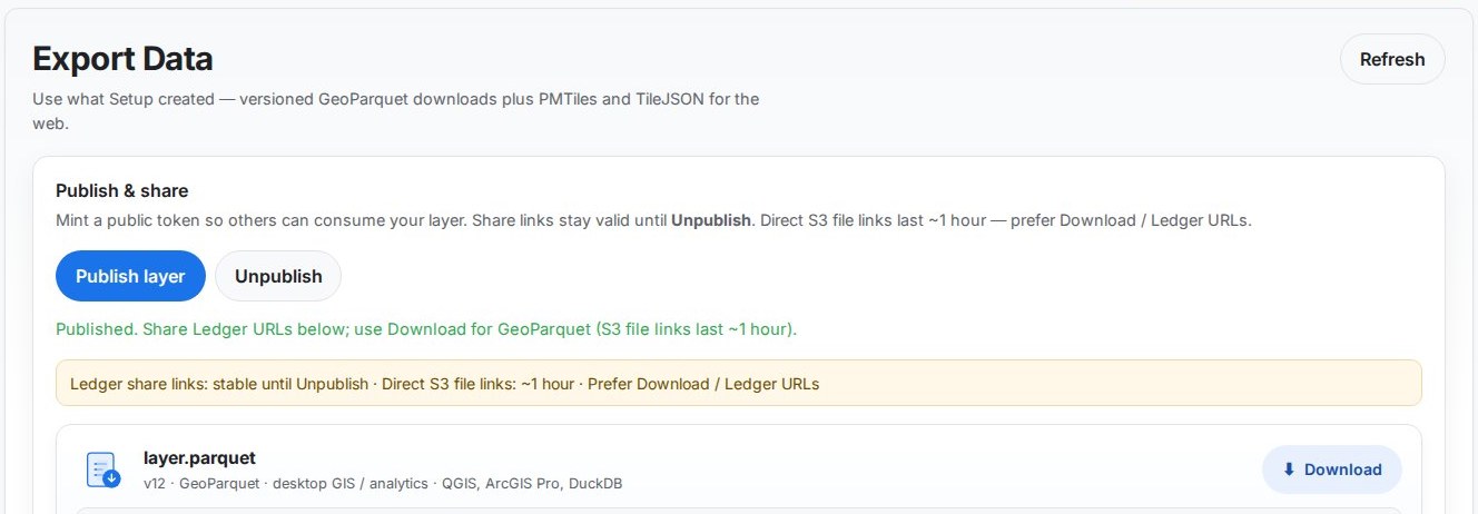
Publish GeoParquet, PMTiles, and a MapLibre web map
 GeoParquet
 AWS
AWS
 QGIS / ArcGIS Pro
The live app serves GeoParquet, PMTiles, and TileJSON for MapLibre. QGIS and ArcGIS Pro can open the lake file. Iceberg and deeper ArcGIS sync are on the roadmap—not what you get the first time you sign in.
A public atlas we built first—3,000+ resorts, web editing, versioned data. It is a related vertical, not Vector Ledger.
globalskiatlas.comThe usual mess: shapefiles in email, a geodatabase nobody else can open, or a web map with no file you can take home.
Vector Ledger: a hosted editor with an approval trail and GeoParquet / PMTiles you can download.
Data platforms like CARTO and Wherobots are strong at lakehouse analytics. We are aimed at the people who still have to change the lines on the map.
Boundary updates, infrastructure tracking, service areas, program mapping—any authoritative geospatial data your organization maintains.
Jonathan Witcoski
Founder & GIS Architect
Fifteen-plus years of federal GIS work (CDC, Census, ARNG, DHS). I got tired of watching good map data die in email threads, so I built Vector Ledger.
Start with one small dataset. Upgrade when you have more layers to keep in play.
$0
One dataset, under 25 MB
$30/month
The main plan for ongoing work
$100/month
For teams with a lot of layers
Free trial is one dataset under 25 MB. Standard is $30/month. Unlimited is $100/month. Send a note and we will get back to you.